Saturday, February 12, 2011

Rattlesnake Canyon, Joshua Tree National Park

My entire body aches.  I went out for a hike in Joshua Tree National Park today and it was more like a scramble than a hike.  My arms are sore from climbing up and over rocks.  My skin hurts from all the various scrapes and scratches.  But despite my sore and battered body I am exultant; I had a great day.The day would have been perfect but I forgot my camera at home--again.  Thankfully, I have my phone and while the pictures certainly aren't as good as a regular camera they'll have to do.  My friend, Cameron, came along and took some pictures.  When he sends me a link to where they're posted I'll put that up.


Rattlesnake Canyon is a boulder strewn crease on the northern edge of the park near the Indian Cove campground.  It's a bit too cool yet for rattlers but there are plenty of other hazards to be found up there.


We barely get into the canyon and find there's quite a bit of water flowing.


Cameron, who's an expert rock climber brought his 19 year old daughter, Charlene, along.  It's obvious she got his genes because she has no difficulty negotiating the many boulders we are required to climb in the canyon.  I am not quite so young and lithe.  


There is no trail in Rattlesnake Canyon.  You have to find your own way among the boulders and make sure you pay close attention.  If you misstep it's a long way down.


Besides climbing over the rocks it is sometimes required to squeeze through a few.  I'm a bit too large for this gap so I go around.


The hiking, at least at this point, is fun, walking along big boulders along the stream.


The geology here is amazing.  How did this boulder end up stacked on three little rocks?


We pick up a couple of stray Marines from Twentynine Palms who are looking for a cave.  Cameron offers to show them but it's too far up the canyon.  They come along so Cameron can show them a challenging shortcut back to the parking area.
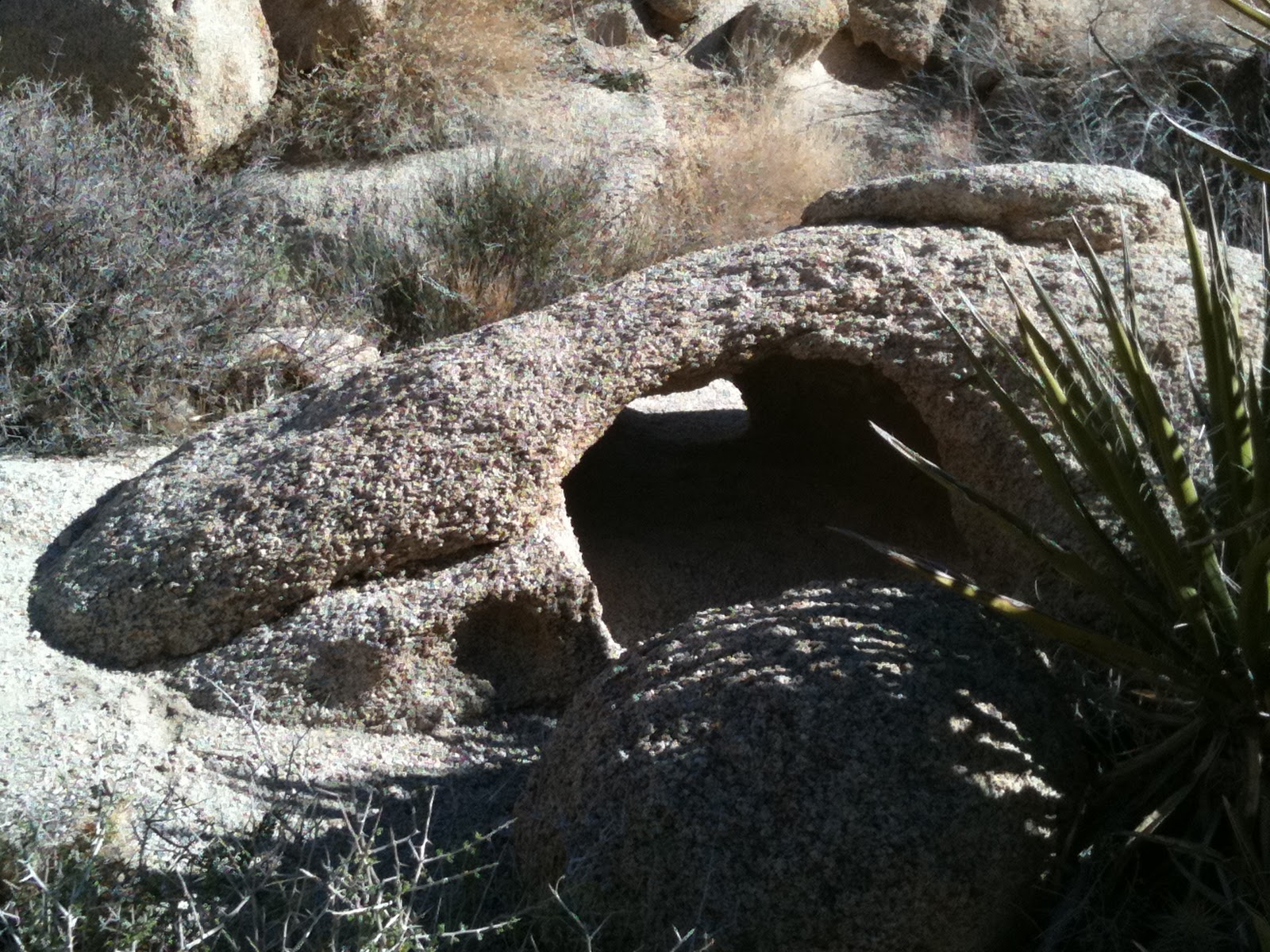

A delicate little arch.


Here's the shortcut--called the Gunsight--that the Marines are going to take back.  Good luck, guys.


The canyon is a place of many wonders and the weather is perfect today, about 72ยบ.


Another tight squeeze.


This rock reminds me of a Picasso sculpture.


We spend a good portion of the day out of the direct sun but sometimes it cuts through the boulders.


But there are some places the sun never shines.  We head into the cave that the Marines were looking for.  There's not much to see in here.  It's dark.


We get up to the head of the canyon and decide that rather than going back the way we came we'll do a little cross country travel and make a loop.


The going was rough to get here but it's nothing compared to our trip down.


The way down is much steeper than the way up.


The going is slow and arduous but still fun. 


Cameron scouts ahead to find a way down. 

There is not one easy step going down this gully.  One moment of inattention could bring about another scratch, a bad fall or death.


Cameron coaches through some tough sections just to make sure his baby girl is safe.  He says he's feeling tired and we'll have to start heading back.  She does not know he's joking and almost has a coronary.  


We just negotiated some incredibly interesting and difficult terrain.  In over five hours we went a little over three miles.


We are finally almost down.


Thank you, JESUS!  It never felt to good to be on solid ground.

Thursday, February 10, 2011

Biskra Palms Trail

A friend of mine called and asked if I could take her husband, Harry, out hiking while they were in town.  I had a few hours on Wednesday and said that I would be happy to.  I only had to figure out where to go.  As I was looking through some old pictures of a hike I did in the Indio Hills, I noticed what looked like a trail behind one of the palm oases that I'd never done.  There are few things more exciting to me than a new trail so I figured I'd go out and give it a look.


To get to Biskra Palms is one of the many oases along the San Andreas Fault and it requires a Four Wheel Drive or at least a car with good clearance to get there.  No problem for me but if you're thinking of going out there keep that in mind.


There is a trail to the East of the oasis but this is not the one I am going up today.  Today's trail is West of the oasis.


Once on it, we discover that the trail is incredibly well made.  There are sections where rocks were stacked to buttress the trail on the otherwise loose and rocky hillside.


Overall, the trail appears to be in good condition although these has been some erosion.


That is, until we get a little higher up.  In this section, there has been MAJOR erosion and the going is very precarious.  One mistake here and you'd slide a long way down a steep rocky slope.  We are very careful going through this.


But we get past it and are rewarded with fantastic views of both Mount San Gorgonio and Mount San Jacinto.


We get a little higher on the trail and discover this little meadow-like basin.  It's a very interesting little clear section that is completely free of rocks in these otherwise rocky hills.


The higher we get, the more we are rewarded with outstanding views of the Coachella Valley.


You are able to see the Salton Sea very well in the distance.


We continue upward and find sections of trail although for the most part the trail ended at the basin area.

There is another basin area just below the top.  Mount San Gorgonio pokes through.


The top.


Since we didn't wear out lead underwear, we won't be going too close to the radio transmitters.


This benchmark is dated 1931 and instead of the usual USGS markings it is labeled Metropolitan Water District.  I guess they put the first towers up when they were building the Colorado River Aqueduct.


We take a different, more direct ridge down and are rewarded with outstanding views the entire way.


At the last moment, we veer down this rocky side canyon as a shortcut.


There are some fascinating things in these hills and there's so much more to be discovered.  I can't wait to come back.

Sunday, February 6, 2011

Not Much To Say

The other day, a guy I work with mentioned  that I should get out and hike more.  Tell me about it!  I had plans to go out and explore another area that I've been eyeing for a while but life got in the way.  My lovely wife needed my help so I took a family trip up to Anza that left little time for hiking.  It was nice to spend a Saturday with family.  Now if I could only get them to go hiking with me it'd be perfect.

I have been going out on little hikes around my house with my dog but nobody really wants to hear about that.  I know I'm not interested in writing about it.  I do have some interesting spots on the agenda and all I need to find is the time.  I hope I can get to at least one this week.  Even though I hiked every day for a year in 2009 I believe there are still some trails in the area that out there yet to be discovered.  There have to be.

The running hasn't happened yet but I've thrown in some exercises to help strengthen my core and I'm getting myself mentally ready for a couple big hikes coming up, including a 35 mile section of the PCT.  Now if I can only tell the rest of life to leave me alone for a while.  I've got hiking to do.

Wednesday, February 2, 2011

I May Start Running

I'll lost more weight in the past couple weeks but not at a very quick rate.  I figure I need to up the ante and start doing a little running on the side.  I've always enjoyed running and have actually run a marathon and several half marathons but I've gotten away from it in recent years.  I just have to remember to start SLOW.  I don't want to get injured.   At my age--and weight--it would be all too easy to pull a hamstring, or get shin splints, turn an ankle, tweak my knee, have a coronary...


One month and almost 14 pounds down.


Monday I had this thorn in my side removed.  This is part of the Agave I fell into.  There are still a few spines still in there but they'll just have to work their way out on their own.  This was the big boy.

Sunday, January 30, 2011

Another Martinez Canyon Adventure

A couple weeks ago I went on an adventure to Martinez Canyon with by buddy, Mike.  The area is filled with a wealth of things to discover and it very seldom visited.  Judging from the footprints in the canyon, since we were their two weeks ago only one other person has hiked there.  I'm hoping we can find a trail leading from the village site we were at a couple weeks ago but you never know what you'll actually discover on one of this expeditions.  The joy, however, is in the looking.


I always feel that you cannot have a truly great adventure until you draw blood.  This day is starting off just right.


We leave the canyon after a couple miles to see if we can find an easier path overland on the mesa above the canyon.  We don't find a trail but we do discover that other's have been here before us.


There are a number of grinding slabs in the area where Cahuilla made their meals.


Pottery sherds are also quite prevalent.


This large flat stone would be the perfect kitchen table.


This area would have been the master bedroom.


This would have been the kid's room.  After traversing the entire mesa we decided to go up instead of down into the canyon.  We thought we might find an easier pathway down to the place we wanted to go.


We didn't.  It's a LONG way down


But the Ocotillo are starting to green up and the views are outstanding.  We also know which way NOT to go.


When we finally make our way back to the canyon--after I have a nasty encounter with an agave--we find remnants of a recent visitor.  With all the things out here that can stick and cut you I don't know why anyone would want to leave their clothing behind.


More recent remnants of inhabitation are some barbed wire fences that we used to keep stock.


This area is an incredibly rich in archaeological interest.  Pottery sherds are everywhere.


Old and newer litter abound.


The newer ones will doubtlessly disappear due to rust.  The Indian remnants will remain.


We make our way back up to the site we were at two weeks ago to look for a trail.  I have a new respect for Agave like those pictured here.  I've got some new body piercings and a few of the tips still remain in my flesh.  My wife tried to dig a couple out last night to no avail.  I'll have to wait until they work their way out, I guess.


Although we saw over a dozen bedrock mortars at this site we come upon a few more that we missed.


We work our way up a ridge but, alas, no trail.  All we're met with is wonderful views in every direction.


We've barely tapped the potential of this wonderful section of the Santa Rosa Mountains.  As we leave today the only thing that's exhausted is us.  I'm looking forward to many, many explorations in this remarkable area.

Saturday, January 22, 2011

South Of Sheep Canyon

Wednesday, I had a few hours between dropping off my son at school and having to pick him up so I decided to go for a little adventure south of Sheep Canyon.  If you are unfamiliar with Sheep Canyon I am not surprised.  It's a small canyon south of Martinez Canyon in the Santa Rosa Mountains.  Not many people go there.  Access is difficult and if you ask me how I got there I would not be able to tell you.  I just drove down some dirt roads until I got to where I wanted to be.

The reason I wanted to visit this little side canyon is because the last time I was in the vicinity I thought I saw some palm trees in the distance.  If there are Palm Trees that means there's water.  Where there's water there were probably Indians and in places the Indians visited there are probably trails.  I love finding new trails.


This is Sheep Canyon.  Once I drop down into it I will take an old Indian trail into the canyon I want to explore today.


As you get back into the canyon the walls become tall and vertical.  I can only imagine the amount of water that was required to cut these walls so cleanly.  In places the walls are almost 40 feet high.

As the canyon narrows, I take off on the Indian trail on the left side.  I know you can't see it but trust me, it's there.

The trail is never very distinct but it is at least visible enough to follow.


As I drop down into the canyon I came to explore I can see the effects of the rain we got last month.  The Ocotillo are full of leaves and soon flowers will be blooming all around the desert.


This is the canyon I came to explore.  No evidence of a trail down here.


But there is evidence of how remarkable the desert is.


After navigating a canyon filled with sand and rocks, it becomes chocked with brush and my legs are not happy.  Note to self: next time up here, wear long pants.


It turns out that those Palms I saw were, in fact, Cottonwood trees.  They are dead from winter but their green leaves are what caused me to think Palms were up here.  It really doesn't matter because Cottonwoods also require constant water so the possibility that Indians were here and trails exist is still valid.


But I run out of time and easy passage.


Looking further up the canyon I see a Palm Tree but oddly it's not a native but a Date Palm.  Intriguing.  There's no way I can get to it without long pants, a machete and more time.  But I'll be back because this canyon holds possibilities.


Lots of possibilities.