Tuesday, I had a whole six hours to go hiking. I wanted to do something different so I decided to go out and find a waterfall in Palm Canyon that I'd heard about but never been to. It's about six miles from the Trading Post and requires some cross country travel to get to it but that's my kind of thing so I was excited to go. Since I'd never been there I didn't want to burden anyone else with a possible wild goose chase so I went it alone. That way I can never complain about the company.

I took off from the Trading Post in the Palm Springs Indian Canyons and it was a perfect day. Sunny, bright, warm with just a few high clouds and the high was expected to be a bit under 80º. What more could I ask for?

I've always loved this little spring in the Indian Canyons not too far from the Trading Post. Anyone know its name? And don't tell me "Palm Canyon Spring".

The San Jacintos—Tahquish Heki or Home of Tahquitz to the Cahuilla—tower above the canyon and seem only a short hike away. Don't be deceived, though. They are thousands of feet above the canyons and would require many arduous hours to ascend.

In a short time, I make it to the a place where the trail splits and I take the fork heading toward Indian Potrero, an old village site. Off to the right of the trail are a group of nondescript rocks that are important in the history of the local Indians and a special archeological site.

These rocks are covered with cupules, a primitive form of rock art that were used extensively in fertility rituals and are often associated with area that were used for giving birth. A local BLM ranger once explained to me that this area was believed to be an area where women came to give birth.

Here is a closer look at some of the cupules.

Doesn't this look like a a good possible birthing spot? Remember, they didn't have epidurals, either.

As I cross the creek heading toward Indian Potrero, there's a decent flow of water but it's not real strong. I'd hoped for more water but let's see if there's more upstream.

I leave the trail instead of heading straight up to Indian Potrero.

There are a few pools up stream that would be fun to take a dip into if I weren't on a real tight schedule.

Palms line the canyon for miles.

And there are many pools of cool water. This one is about thirty feet below me and I'd be tempted to jump into it but I have no way to get out, so I keep going.

But this little slot canyon would be fun to come back and explore sometime.

And as clear as the water looks downstream this is where it comes from. Would you really want to drink this?

I head up to Indian Potrero and it's easy to see why this was a major village site. It's level with good drainage, good food sources nearby and wonderful views.

It also offers multiple baths.

I continue on to Mesquite Flat where the trail bisects a huge mesquite patch. This would have been a major food gathering area for the Indians. Thinking of this makes me hungry and when I stop to get a bite to eat, I realize I left my lunch on the kitchen table at home. When I plan on doing a fast hike, this is not quite what I have in mind.

A bit further on, I come to the fork that leads off to Little Paradise. This is the way I go.
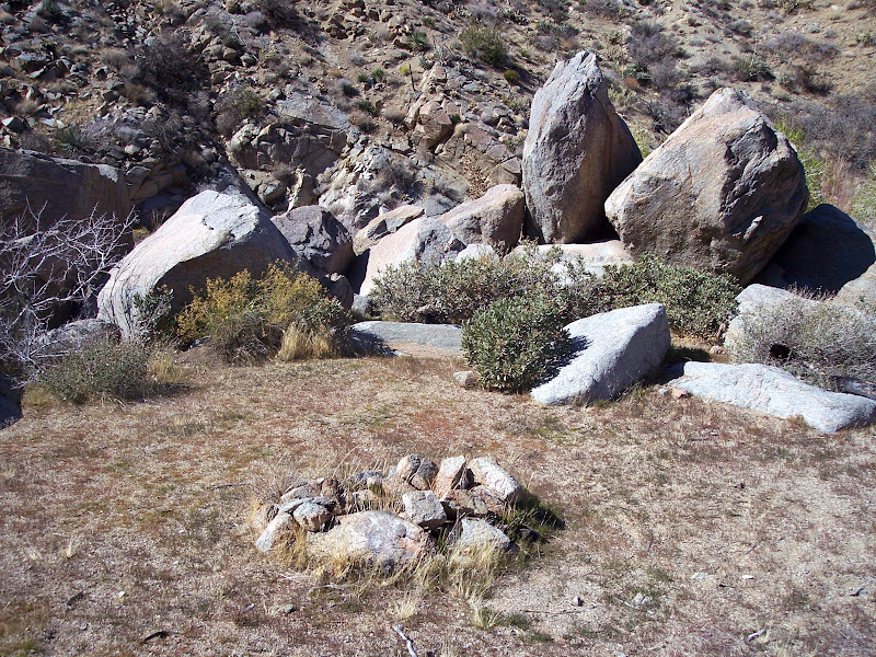
There's a fantastic little campsite just before coming back down to the creek.

It's obviously been used for a LONG time.

Although the water source here leaves a bit to be desired.

More cross country travel brings me into Little Paradise. The name is a bit deceiving because it's an area chocked with brush although it's obvious that some building went on here, perhaps by early ranchers using this area to graze their cattle.

Looks like they left some bags of concrete out in the rain.

They also left the remains of this old cot.

Now I just have to drop back down into the canyon. It's steep, loose and filled with leg shredding vegetation. Looks like fun.

Part way down I get to where I can see the falls. They appear to be about 100 feet tall but there's not a lot of water.

I get into the canyon bottom and start working my way toward the falls but don't get too far. The going is difficult with lots of growth in the canyon bottom and a lot of rock hopping.

I have to turn back before I get to the base of the falls. When I set out on this adventure I set myself a solid turn around time and I've already gone past it. I've got a kid to pick up at school so I've got to go. This is as close as I get but I'll be back.

It's a beautiful little spot filled with Cottonwoods and maybe a bit later in the season we'll have some more water coming over the falls.

If only I could drive here like this guy did. OK, this probably just washed down the canyon. There are areas here with debris over 15 feet above the canyon bottom. When the water is that high that's got to be crazy to see.

On my way out of canyon I spook two deer who lead me on the best path out of here.

I've got to hoof it out of here so I can get back on time. It's only 4 ½ miles from here.

Note to self: take the Indian Potrero fork of the Palm Canyon Trail at all times in the future. Despite beautiful views such as this one, the other fork is mostly boring washes and has more hills.
The Falls are a special place and I plan to get back there many times in the future. I just have to remember to give myself more time—maybe overnight—and to bring some food next time.


